Marking a line, pathways, territories and boundaries in the landscape.
9:36 am
Introduction
The pathways and patterns of movement across landscapes have become a significant archaeological and historical challenge of ancient and indigenous cultures as generally our understanding has been determined by uncovering the places of settlement.
Bruce Chatwin posed the fundamental question about human restlessness and our innate need to travel when he ventured through Central Australia for his book ‘Songlines’ (Chatwin 1986). Towards the end of his journey and after interaction with various indigenous elders he speculated whether the Songlines was a universal phenomenon which have been employed by ancient cultures across the world. The ‘ancient circles, menhirs and graveyards’ which had been laid out in lines across Britain, have also been found in Finland, China and even further afield in Peru with the famous Nazca lines, ‘etched into the meringue like surface of the Peruvian desert’. But in Australia the Songlines are ‘mental constructions’ which are not just a memory connection to landscape but linked to trade which meant greater social interaction and friendship. They are also a song which has come from somewhere else. A connection beyond which follows back to the early humans who stood and moved from the Savannah of southern Africa. (Chatwin 1986)
Other cultures have also relied upon lines for paths not just for travel, but as a means of control or to mark territory. How is that some lines remain and others like the paths of Songline’s remain an intangible cultural practice completely silent to those not able to speak the language or sing to connect to place and country?
The expansion and colonization of the European powers especially after the 16-17th centuries created a complete disruption to this not just in Australia but across Asia, Africa and the New World. (Benevolo 1995)
The new colonial city in Australia created opportunities to build a reimagined city perhaps or later an ideal garden city as promoted by Howard in the late 19th century (Freeman). This seemed more attributable to the nature of land tenure and governance under the British Colonial office than other factors. Most Australian colonial planning seemed little more than two-dimensional with the survey grids outlaying new town centres especially following the discovery of gold in the early 1850’s in Victoria and NSW (Freeland 2008).
The establishment of the new colony of Victoria was driven by agricultural interest from Tasmanians who had long sought to establish a foothold on the mainland (Boyce 2012) However following establishment of the Melbourne township and the first leases the conditions for a settlement proved very accommodating and with the approval of Sydney administration allowed Batman, and separately Fawkner to establish the new settlement of Melbourne. (Boyce 2012)
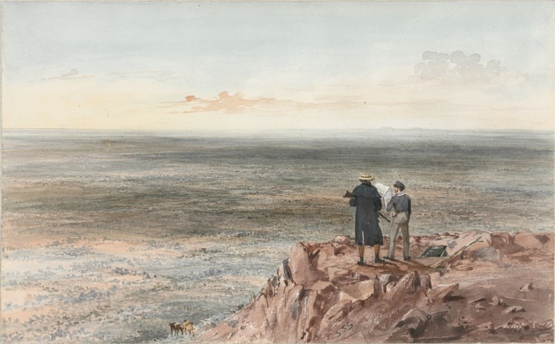
In 1837, Robert Hoddle’s layout for central Melbourne was adapted to Governor Darling’s regulations from the 1820’s (Freeland 2008). A rectilinear layout extended beyond the new grid orientated to cardinal points. Batman’s camp was a ‘pleasant’ location to the south as was much of the Victorian countryside which presented open wooded country ideal for driving livestock, namely sheep, named “Australia Felix’ by Thomas Mitchell in his writings cataloguing his expedition during this time. Bill Gammage refers to a ‘gentleman’s parkland estate’, ideal for sheep grazing squatters who pushed through with their herds to occupy (dispossess) the countryside.
A small knoll named ‘Batman Hill’ by Hoddle to the south west of his new grid layout was to be a key survey point for a one-mile grid which radiated out a fore marker of the new arterial roads of the ever-expanding metropolis which was to follow. (Freeland 2008)
The use of surveying and alignments to cartesian coordinates has arguably been a greater determinant in the new urban settlements than other factors although geographic features also affected the expansion of the new towns and cities. Batman’s Hill is no more, cleared in 1870 to allow for new rail and port facilities to the south west of Hoddle’s Grid.
It would appear the rampant population growth and occupation due to the discovery of gold determined patterns of settlement before any other determination of site could be established. (Boyce 2012)
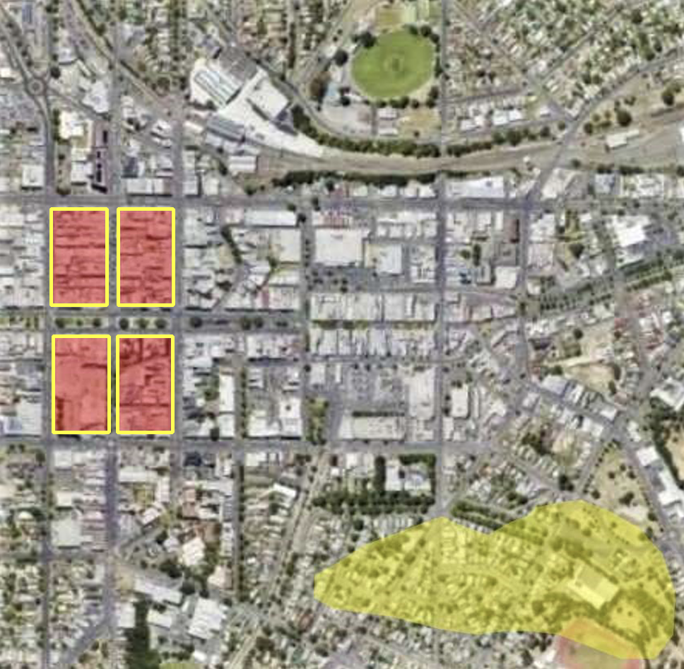
The layout of the new township of Ballarat by William Urquhart in 1852 is a case in point. The grid of the city plotted the first blocks of town on an elevated basalt plain which was remote and above the frantic activity of the prospectors madly excavating and cleared the timber woodlands along the Yarrowee Creek to the east. The Government camp had been established on the high ground, as the soldiers kept a keen eye on the diggers below. It should come as no surprise that tensions would fester and relations fester as the soldiers remained aloof and remote from the trials of the camp.
The urban pattern and formation of the city formation is still evident to this day. Ballarat East reflects the seemingly haphazard nature of street patterning and built form made smaller modest landholding of the prospector and smalltown street store vendor (as well as the Chinese internment camp). In his 1852 survey map, Urquhart coloured an area notated Golden Point (further south of the actual suburb today) with a gold shaded area referred to the main diggings. Later surveys would attempt to straighten outlay new allotments set to the pathways and alignments of these meandering streets following these settlements patterns rather than introduce a new overlay of the cartesian grid.
Whilst settlements in the world especially in the interior of Victoria and New South Wales also were due to the discovery of gold and mineral exploitation. The ports of which there were few with deep protected harbours also proved difficult, Portland, or Port Phillip Bay.

The Apennine Mountains run as a series of chains of along the Italian peninsula for over 1200km. Mostly ranging from 1500 to 2000 metres high with its highest peak the Como Grande, Gran Sasso Massif at 2,912 metres in Abruzzo.
The north section of these mountains was settled by Celts and Etruscans who travelled along the Apennine to develop trade and control over the Po Valley. A number of hill top settlements remain to this day.
However, after having founded the colony of Bononia in 189BCE, (now modern Bologna) the Roman Empire begun to expand from Rome, felt the need to guarantee a connection with Arezzo and Rome via the Apennines and built, on the Etruscan route, a real road, the Flaminia Militare.
One of the most tangible cultural assets of Roman structures which survive in the landscape this day are the aqueducts, bridges and roads which radiated through the European especially Italy and further, North Africa and Middle East. (Benovolo 1995). These feats of Roman engineering ingenuity have often been considered fundamental to Roman military conquest which started to emerge around 450BCE to 187BCE. (Liccio 2014)
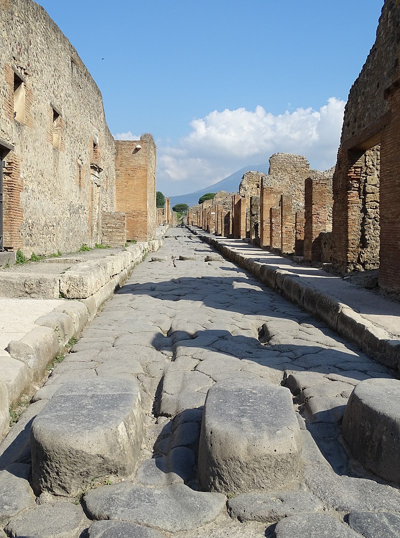
Roman Roads were critical to maintaining its army and control over territory. This started within Italy and then expanded especially under Julius Caesar and Octavian (Augustus). Often these roads followed the same pathways established by the Etruscans however recent research is re-examining their importance and how fundamental they were to establish control of new settlement and control.
Whilst trade via the sea was far more efficient at the time, navigating the Mediterranean in winter month storms was extremely hazardous and thus a road network offered all year-round safe passage. (Licio 2019) Further it has been suggested that by maintaining such a road network the Roman Empire was able to control its ever-expanding territory with less soldiers and ensure the most essential supply lines for livestock, fodder and food.
Via Alumenia
The Via Alumenia is arguably the most prominent as it followed the edge of the Po Valley along a similar route established by the Etruscans and Villanovans (ref). The expansion of the Roman Empire followed and with-it alignment of the cities and towns between Pescara and Rimini, and a direct link to the Adriatic Sea.
In Bologna, founded in 189BCE the main throughfare of city centre of Ugo Bassi and Vue Rizzoli follows the same Roman Road, and despite the subsequent of the overlay of medieval city state development which followed.
Via degli Dei (Path of the Gods)
Despite its name there are few sacred or religious sites on this road which relate to the naming of the nearby mountains Monte Adone, Monte Venere and Monte Luario (Goddess of the Moon).
The Pathway of the Gods is now a hiking trail follows an historic Roman Road between Bononia (Bologna) and Fiesole near Florence was an important trading point. Following the fall of the Roman Empire the road became less travelled to eventually disappear altogether. Its recent discovery by two Bolognese academics demonstrated not just a theoretical understanding of Roman engineering but the nature and need for these structures. Further assisted by geo spatial mapping, new archaeological research is reconsidering the importance of these structures in the ancient within the Roman Empire at its peak. (Liccio 2019)
In 1979 Cesare Agostini and Franco Santi carefully analysed the topography of the Apennine Mountains mapping a pathway which followed the lowest grade between these cities. There early excavations soon revealed the old road which today this road has become a popular hiking trail as further exploration continues.
The importance of transportation links is fundamental to Italians today as they crisscross the country for work and/or study. Availability and affordability issues with housing necessitates many Italians to commute movement with regional stations like the Bologna Central Station exceeding 150 million passengers’ numbers a year, a similar volume to Flinders Street, with a city 5 times the population.
The other influencing factor here is the use of the grid and cartesian orientation. This is not confined to the Roman planning; one example is the Incas in Peru. Johan Reinhard contends cartesian direction played a key part in the organization in Cusco and Macchu Picchu. The alignment to astronomical features such as the southern cross is also significant as this also had significant spiritual relationship and the junction between the mountains, and Amazon basin beyond. Location of the mountain top site of Macchu Picchu was central to these relationships
As the settlement of Sydney and other outposts established by water navigation such as Norfolk Island, Hawkesbury, Parramatta, Newcastle. Early self-sufficiency proved difficult for the fledgling settlement and reliance on external shipping from Cape Town with greater success at Norfolk Island. In 1790 the Second Fleet nearly wrecked off the coast of the Tasmanian west coast which was narrowly averted the colony would have starved. (Mundy 2010) As Sydney settlement became established, expansion of the colony followed access via sea rather land with the Hawkesbury and Hunter valleys.
Local Gundungurra and other indigenous peoples used two main routes to cross the Blue Mountains. Most Europeans saw the range as a forbidding maze of sandstone bluffs, deep gorges and dense bush. At first, the colonists were too busy surviving to consider trying to cross. (ref) The fledgling colonial settlement struggled to grow food and nearly faced starvation were it not for the arrival of the Second Fleet in 1790 (Mundy). When Governor Lachlan Macquarie arrived in 1810, a combination of drought, insect plagues and exhaustion of the soil around Sydney made finding fresh lands imperative. The natural barrier which has contained Sydney’s growth to the west was a major impediment for the new settlers to cross until William Wentworth with Blaxland and Lawson trekked from western Sydney to near present-day Bathurst. Ref State Library NSW
Whilst most of the Blue Mountains remain to the north and south with National Parks and reserves, traditional pathways are reflected in other cities. The famous Broadway cuts across the Manhattan Grid follows a traditional route of the Lenape, local indigenous Indians. Bearing remarkable similarity to the events with Batman, Dutch of the southern end of the island.
The edge of the fortification aligns with present day Wall Street with Broadway terminating at Battery Park Adjacent to the site of the Castel.
1854 – 1890 Victorian Railways
The establishment of the railway line between Melbourne and Ballarat took more than 40 years to be completed due to the steep grade of topography in the Parwan Valley, Bacchus Marsh and Pentland Hills. The rail way still follows a similar alignment after the upgrade of proposed Fast Rail Project in the early 2000’s. Further upgrade of rail has been limited since the 1950’s where increasing reliance on road transport and air travel has dominated. Investment in rail has been spasmodic, as an example the commuter times for rail declined from 1950’s through the 1990’s.
The upgrade of rail services has been hampered by the fact that passenger rail for both regional and suburban rail lines share the same track. In recent years greater investment such as the Regional Rail Upgrade completed in 2015 of which its stated aim was to improve connection and travel times to regional centres. (BITRE 2015) Arguably improved patronage growth is further encouraging greater population movement to regional centres which has also been exacerbated by increasing house prices in the major cities, especially Melbourne and Sydney
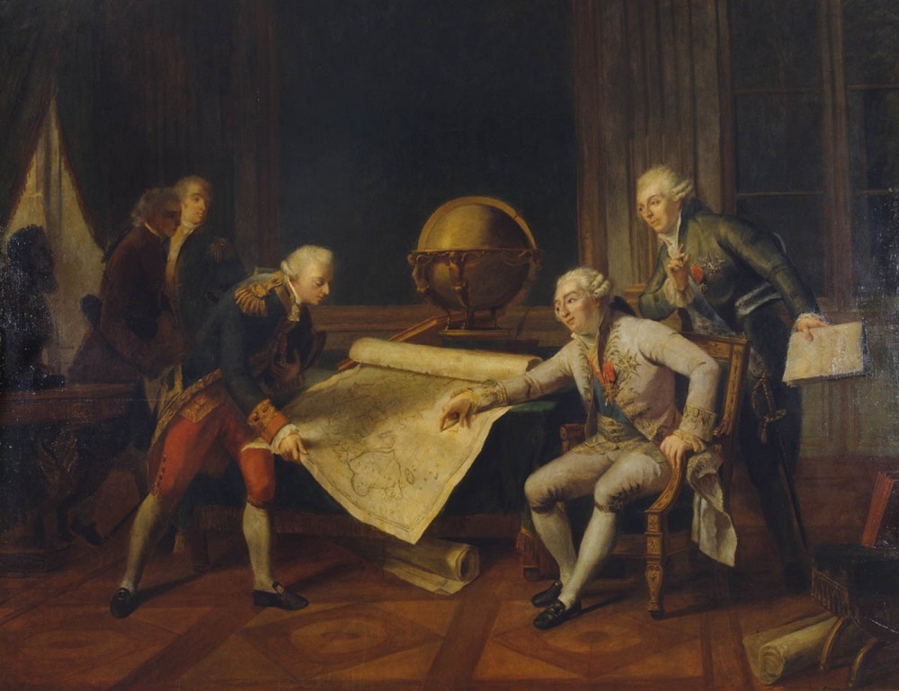
The French Explorer Nicholas Baudin entered Sydney Harbour on January 26th 1788, was it mere coincidence that Captain Arthur Phillip and his officers made for the shore and erected a union jack declaring the eastern continent as sovereign country under George 3rd the same day?
French naval exploration covered significant areas of the Australian coastline and interest of science, botanical. Over the next thirty years no less than 15 expeditions would visit the Australian Coastline.
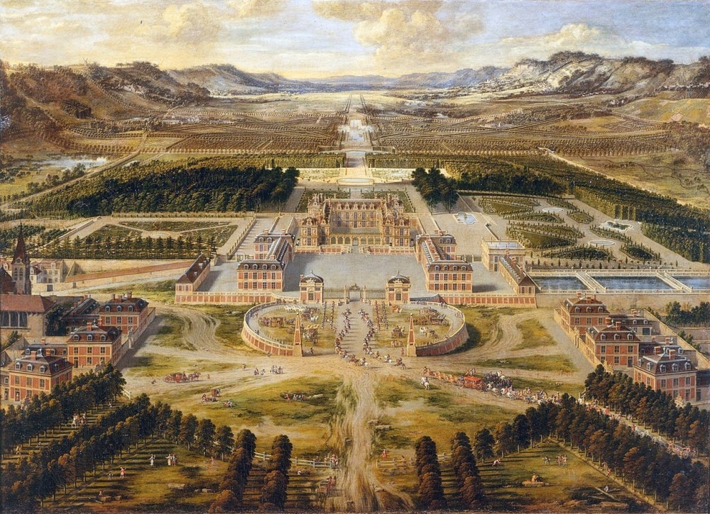
The Palace of Versailles
The endless city and extent of empire suggests an expansion of the endless city and empire.
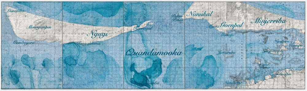
Megan Copes artwork explores the relationship of the early French explorer’s and their interaction with indigenous Australians.
Part of an exhibition which catalogues the emergence of an era now referred to as the Anthropocene where human activity is physically changing the earth systems on a global scale. Human settlement and its interface with the landscape
Early mapping of the Australian coastline and scientific discoveries of their time always seemed to experience the country from the edge, and without navigable rivers, venturing into the interior proved a greater challenge.
Pathways and layouts become more determined by axial relationships mimicking or urban emulation of European and English/French ideals. The Beau Arts tradition was an important part of local architect’s education and therefore it would seem logical a French influence would take hold in Australia.
Chapter 2
Garden City planning influences in Australia and establishment of the city ideal of Canberra The Ideal Australian City
Following the recession of the late 1890’s coincided with the emergence of town planning as architects discussed the future city in Australia. The growth of suburbs with the established railways and electric tramways the ideal town of the future has been considered to renaissance terms, wide street, symmetrical vistas and formal parklands. However according to Freeland, planners abandoned the grid street patterns in favour attuned to the landscape (Freeland 1968). Garden city design ideal became most prominent in the late nineteenth century English planning and this in turn.
The creation of the new Federation and Commonwealth of Australia presented the opportunity to consider a new capital for the country. The selection of the site and presented a number of issues and differences as to what this city ideal should be. And together with one of the first planning conferences a number of papers were presented discussing the ideal of the city. Sir John Sulman presented a plan based upon the garden city ideal one of only a few, which bears similarity to the Garden city ideal and the winning entry. (Freeland 1995)
The competition for the new capital of Australia in 1911 was controversial even before the awarding of the winning design entry to Walter Burly Griffin and Marion Mahoney. The competition was marred by a dispute over conditions and therefore led to a boycott by many of the prominent planners of the day. (Freeland 1995) Further criticism followed that the winning scheme did not strictly follow more garden city ideals utilizing a formal alignment with Mount Ainsley, the new capital has marked influences especially to Washington DC, Chicago’s White City and New Delhi.
After Burley Griffin’s resignation in 1920, the new capital authority was led by Sir John Sulman altering the plan and the influences of American planning came to the fore of grater landscaping and boulevards. The new civic centre follows these principles, Los Verdes Estate in southern California, with the Pacific sunshine and eucalypt trees which imagines a more localized design response than something transplanted especially from Europe. Other new American cities to capture local attention was Pasadena, Palm Springs. (Freeland 1995)
The significance of American city ideas began to wane as the sprawl of Los Angeles highlighted urban problems like traffic congestion with increased air pollution from private vehicle use as well the tremendous sprawl time and dormitory suburbs.
But the enduring legacy of Canberra remained as nodes with radial lines allowing for greater space, curved street alignments, use of natural trees and landscaping. Burley Griffin’s plans for Castlecrag would later demonstrate this ideal but preceding this development were other examples such as the garden city developments in Sydney like Dacey Garden Suburbs. Most of these encapsulate an Australian suburban ideal and especially of the single detached dwelling set within generous tree lined streets and parkland rather than a more city centre urban ideal.
Conclusion
Melbourne’s development is seemingly caught between contradictory influences.
Compression or what was euphemistically referred to as ‘Urban Consolidation’ in the early 2000’s proposed greater medium density but has become more prominent especially for the city centre is the extent of high rise residential, At the same time dispersal or expansion continues now more to the west and north which has been actively encouraged since the early days of settlement.
The outcome of these tensions presents a series of very different and often competing outcomes which as Freestone suggests allows for a variety of possible models to be experimented. (Freestone 2008)
The main driver of new development in recent years has been residential housing which is still predominately single detached dwelling despite the significant increase in unit apartment towers and town house development. However similar to other capital cities (with the exception of Canberra), Melbourne is a laboratory of modern planning which vary in quality and outcome. However, as Elizabeth Farrelly suggests, to achieve greater quality in our city environments we must be able to deal with some of the fallacies have persisted. One is the neo-liberal agenda which allows the market to dictate such a narrow view and outcome. We must replace the consumer with citizen. Further I would suggest we need to be able to find our own or shared pathways, to connect and allow others to participate more fully.
Batman Hill is no more but Melbourne City Council’s latest iteration for Yarra River is to draw upon linking those elements which have been recently created like Birrarung Mar and link them to the new. And whilst the changes have been radical since 1835 there maybe a sense to imagine what might have been before and how might we move and connect again.
9:36 am
9:36 am